![]()
![]() exploring Bremen & its surrounding areas
exploring Bremen & its surrounding areas
![]() You are here: worth seeing in the surroundings
You are here: worth seeing in the surroundings
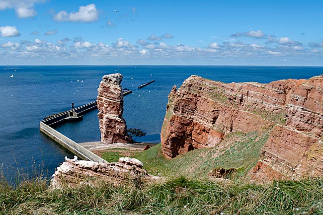
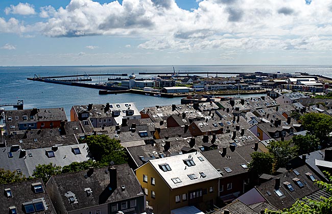
 Heligoland: the rock in the surf (1/2)
Do you have to see it? No, but you can and it’s fun. And it’s unique: Germany’s only high-seas island, though for several reasons, one can’t really call it "high seas." Located just under 50 kilometers off the coast of Schleswig-Holstein, it attracts thousands of visitors each year, most of them day-trippers in the warmer months.
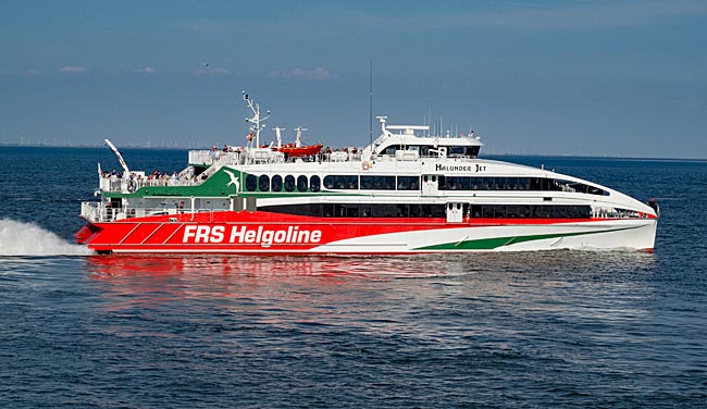
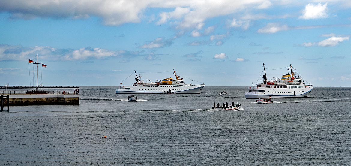
The fastest way to reach Heligoland by sea is aboard the catamaran Halunder Jet, pictured here shortly before its return to Cuxhaven
And yes, admittedly, Heligoland isn’t right next door to Bremen. The reason it appears as an excursion destination here is simple: it’s accessible as a day trip from the "Alte Liebe" pier in the harbor of Cuxhaven, a city in Lower Saxony at the mouth of the Elbe. The traditional practice of transferring passengers from excursion ships to smaller wooden boats called Börteboote before reaching the island is a dying tradition - but since 2018, it has been recognized as a UNESCO World Heritage Site.
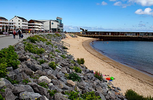
Promenade of the Lower Town with beach
Upon arriving on Heligoland, you’ll encounter a statue in the promenade of the Lower Town honoring August Heinrich Hoffmann von Fallersleben on the occasion of the 175th anniversary of the German national anthem in 2016. Of course, von Fallersleben couldn’t appear in person for the celebration - he’s been dead since 1874 - but in his honor, a bust was placed on a pedestal here. Strictly speaking, only the lyrics by von Fallersleben were being celebrated, as the melody of The Song of the Germans had already been composed in 1797 by the Austrian composer Joseph Haydn for another occasion. And even more precisely, the song wasn’t declared the national anthem until 1922 during the Weimar Republic. The fact remains that von Fallersleben wrote the famously sung verses in 1841 during his stay on Heligoland.
Landing bridge in front of the Lower Town
At the time, however, the British flag still flew over the island. There’s a persistent rumor that Germany later acquired Heligoland in exchange for the island of Zanzibar, located off the coast of Tanzania in the Indian Ocean. Although Tanzania was then known as German East Africa and a German colony, Zanzibar wasn’t part of it, consigning the rumor to the realm of fantasy. With the 1890 treaty, the British sought to curb further German territorial claims on the African continent and gave up Heligoland in return, a deal that looks good from today’s perspective.
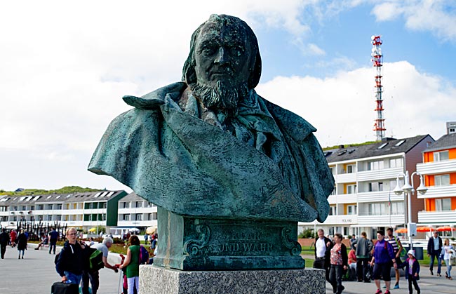
Bust was placed on a pedestal here
Von Fallersleben wasn’t the only artist inspired by the island with its distinctive sandstone cliffs. Georg Christoph Lichtenberg, Friedrich Hebbel, and Heinrich von Kleist were also captivated by Heligoland, as were the painter Elisabeth Reuter and the Düsseldorf-based artist Rudolf Jordan, who made the island the subject of his oil paintings "Storm Bells on Heligoland" (1839) and "Wedding on Heligoland" (1855). The writer James Krüss was even born here in 1926, making his homeland a recurring setting for his stories, as in his famous book "My Great-Great-Grandfather and I". The isle, which has officially been a North Sea spa since 1962, enjoyed great popularity and experienced an unprecedented influx of visitors by the mid-19th century.
On a walking tour, however, you’ll notice that the architecture seems entirely out of place with centuries of human settlement, there’s not a trace of old buildings. Why is that?
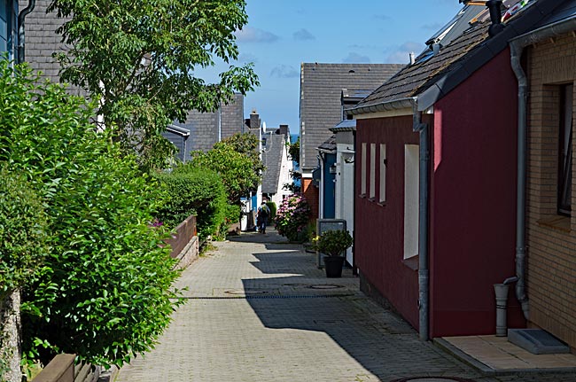
Street in Upper Town
The answer lies with both Germans and the English, and the history is politically explosive. After the island came under German control, Kaiser Wilhelm II established a base for the Imperial Navy there. Just after the outbreak of war in 1914, it engaged in its first naval battle 25 nautical miles west of Heligoland against ships from the militarily superior British Royal Navy, which sank four German vessels. After the evacuation, the population couldn’t return to the island until after the war ended in 1918. Following the dismantling of military installations, a massive expansion of the base occurred under the Nazi regime, including U-boat bunkers, naval artillery, and an air force fighter squadron. This also involved a network of bunker tunnels with air-raid shelters driven through the sandstone. Some of these can still be seen today, such as exits in rock faces and the civil defense bunker, which can be visited.
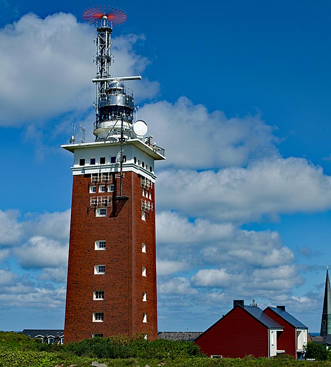
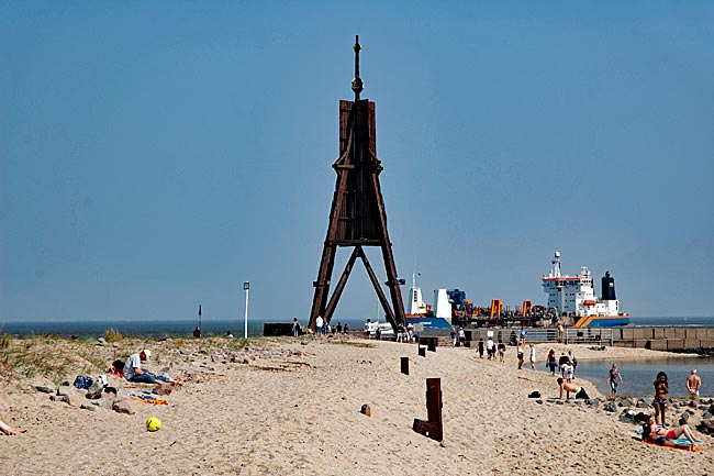
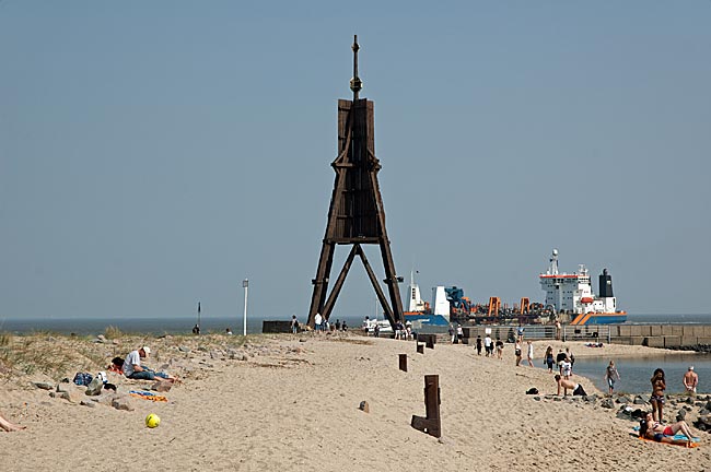
The former flak tower made of red brick, which has been used as a lighthouse since 1952 and can be seen from afar
Just before the end of World War II on April 18–19, 1945, Heligoland became a target of the British Royal Air Force with devastating consequences. Some 7,000 bombs were dropped on the island, rendering it initially uninhabitable, but that wasn’t enough for the British. The population had already been evacuated, and the Union Jack was once again flying in the North Sea winds of the German Bight when, two years later in 1947, experts stacked torpedo warheads, depth charges, and grenades in the bunker facilities in thousand-unit packs. With a total explosive force of 6,700 tons, this was intended to be the largest non-nuclear military detonation to date, as if they wanted to sink the island into the sea for good. As we know today, that last part, whether intentionally planned or merely accepted as collateral damage, didn’t work. After the several-kilometer-high smoke had cleared, it became clear that the coordinated explosion had permanently altered the island’s surface. The destruction of the U-boat bunker at the South Harbor, for example, created today’s Mittelland. In the years that followed, the area remained a military training ground and only returned to German ownership in 1952.
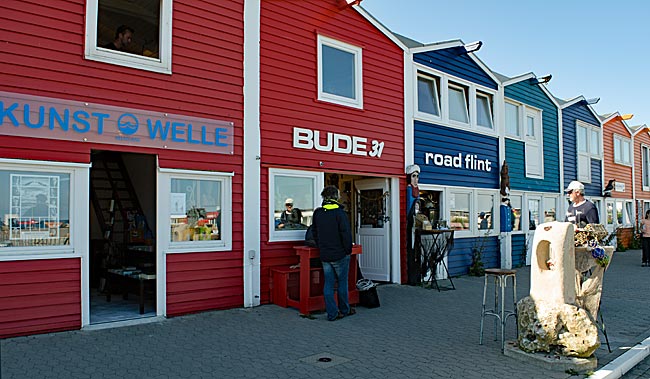
The so-called Hummerbuden (lobster huts)
Heligoland thus rose from the ashes like a phoenix beginning in the 1950s, which also explains the architectural style. A remnant from the war is the former flak tower made of red brick, which has been used as a lighthouse since 1952 and can be seen from afar. The most striking buildings, however, are probably the so-called Hummerbuden, which line up along the Binnenhafen with their colorful wooden facades. Designed by architect Georg Wellhausen of Hamburg, these two-story structures were erected in 1952 and are now protected as historic monuments. Originally used by fishermen as sheds and workshops, they have since been repurposed.
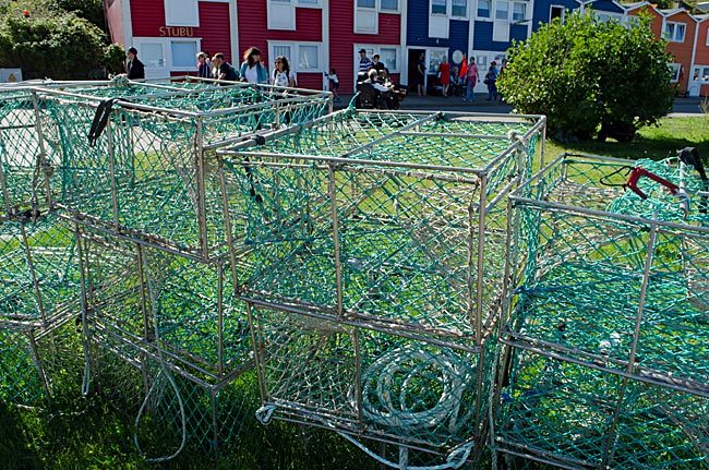
Lobsters are caught with such cages
Since the early 1990s, the Hummerbuden have been utilized under a new concept. The Hafenstraße, once a street for fishermen, has transformed into a tourist promenade featuring shops ranging from art to commerce, restaurants and cafés, clubs, and even the volunteer fire department nearby.
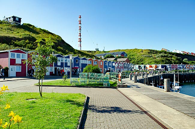
Somehow a promenade between the South Harbor and the Lower Town: the Hummerbuden
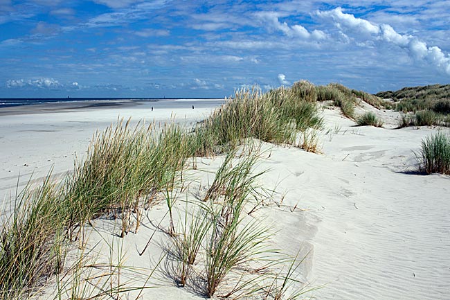
To explore the island, which is only 1 km² in size, you don’t really need a plan. The Upper and Lower Towns are so compact that it’s hard to get lost, unless you indulge too much in the abundant offerings of alcoholic beverages. Although Heligoland is part of German territory, neither the main island nor its neighboring island belongs to the EU customs area, and no consumption taxes are levied. As with the former "butter trips," visitors can purchase alcohol and cigarettes in limited quantities duty-free and without value-added tax - a good deal.
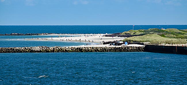
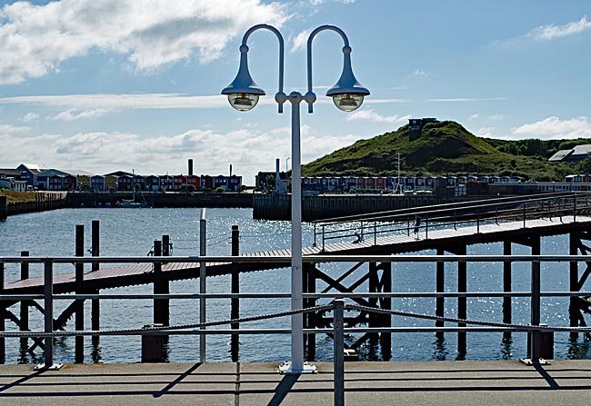
View of the aforementioned neighboring island, Düne
From the Lower Town, an elevator takes visitors to the Upper Town, though the stairs right next door are free of charge. From an intermediate level, you have a view of the aforementioned neighboring island, Düne. It was only a storm surge on New Year’s Eve in 1721 that turned this much flatter island into a separate one. Recent considerations to reattach the slightly smaller Düne were rejected by the population. That might be for the best, as it keeps the isle largely free from the stream of day-trippers, since there’s usually not enough time for a visit via shuttle boat. Consequently, life on the island is much quieter, with accommodations available for long-term guests and locals who mostly keep to themselves.
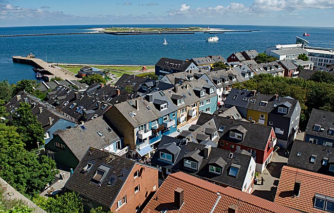
View from the Upper Town to the Lower Town, with the Düne in the background ...
Almost? Yes, you have to share the beaches with seals, which also bask and doze on the fine sand. Nowhere along the German coast can you get as close to these agile swimmers, who weigh up to 300 kilograms. They look adorable with their large dark eyes and soft fur, but they are predators and faster on land than one might expect. Therefore, caution and a respectful distance from humans are absolutely necessary. Just looking, not touching, especially from November to January when the harbor seals have offspring.
... and the view in the other direction with the harbor
The Düne can even be reached by air. During the Third Reich, the military leadership wanted to build a large seaport near Heligoland, but little came of the "Hummerschere" project. However, the airport was completed and is still served by small aircraft today.
previous page![]()
![]() next page
next page
Map
Further information
Heligoland Tourist Office
Lung Wai 28
27498 Deät Lun / Heligoland
Phone: +49 (0) 4725-8143-0 (Main)
Fax: +49 (0) 4725-8143-28
Email: info@helgoland.de
www.helgoland.de
Peak travel season: April - October
How to get there:
Airplanes fly from Heide/Büsum and Cuxhaven/Nordholz, www.flughafen-helgoland.de, www.fliegofd.de/inselfluege/helgoland-heidebuesum.html
A catamaran departs from Hamburg with stops in Wedel and Cuxhaven. www.helgoline.de
Ferries operate from Büsum, Bremerhaven, Cuxhaven, and Sylt. www.cassen-eils.de, /www.adler-eils.de, www.adler-schiffe.de/ab-sylt/helgoland.php
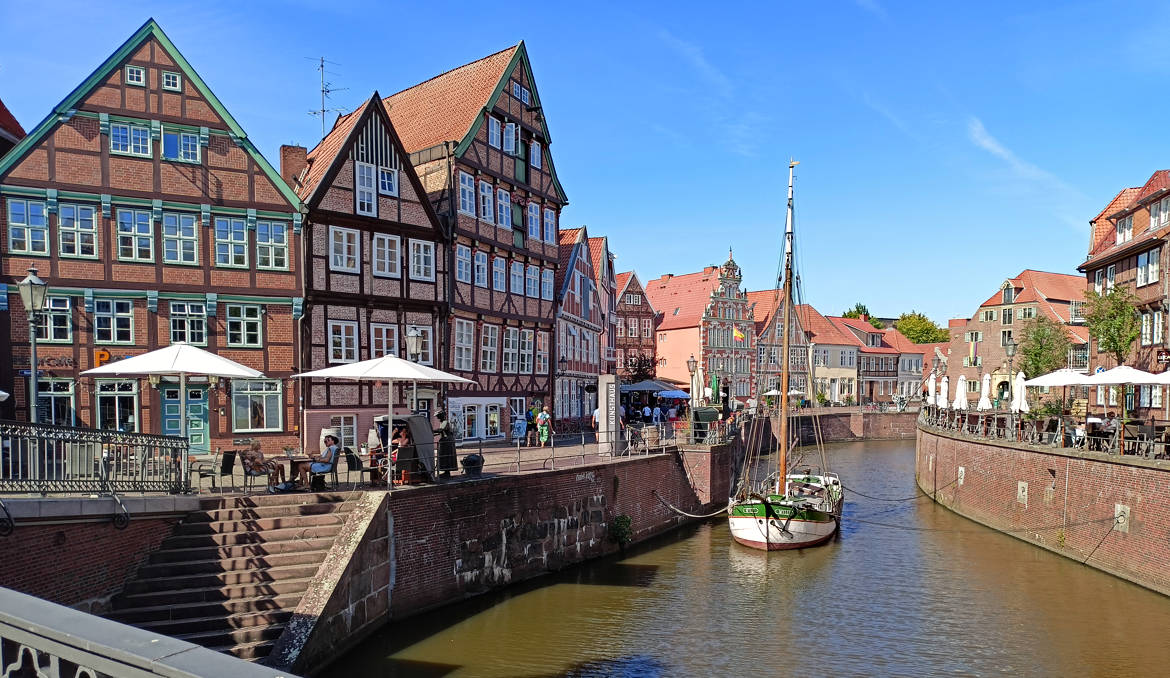
Stade - on the banks of the Schwinge River
Do you know Stade? No? What a shame! Then feel free to read on if you'd like to learn about this smaller Hanseatic city on the Elbe, neighboring the much larger Elbe metropolis of Hamburg. As is often the case, the tourist's gaze doesn't fall on the entire city but rather focuses here on the historic city center and a bit of its surroundings. In our opinion, Stade is a beautiful and worthwhile destination for a short visit or even a few extra days.
read more ...
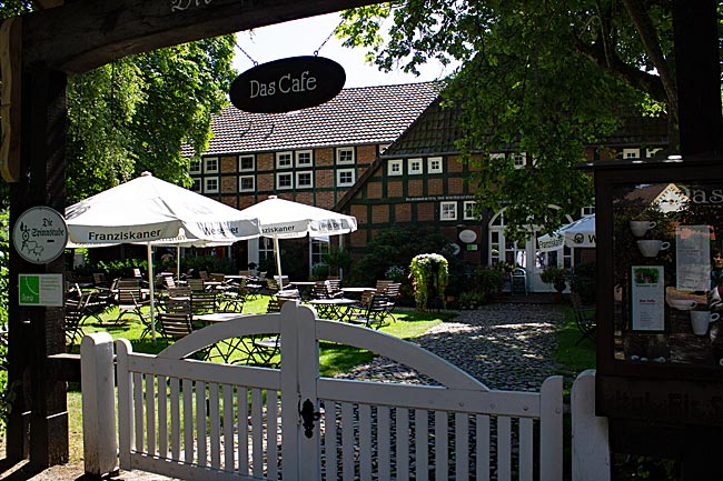
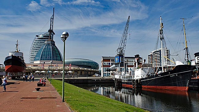
Bremerhaven in general
Bremerhaven was only founded in 1827. To secure its status as a port city amid the threat of the Weser - Bremen's lifeline - silting up, Bremen purchased 342 acres of land at the mouth of the Weser from the Kingdom of Hanover for 74,000 talers under then-mayor Johann Smidt. About 60 kilometers downstream from Bremen, this became the site of the first urgently needed seaport built by Bremen, known as the Alter Hafen (Old Harbor), completed by 1830.
read more ...
Bremerhaven - Zoo am Meer (Zoo by the Sea)
In addition to the 19th-century harbor facilities, the Zoo am Meer is the oldest attraction on the site between the Weser River and the pedestrian zone. It opened in 1928 under the name "Tiergrotten." The enclosures house polar bears, seals, penguins, various bird species such as gannets and keas, reptiles like turtles, raccoons, Arctic foxes, pumas, monkeys, and others - almost 50 animal species in total.
read more ...
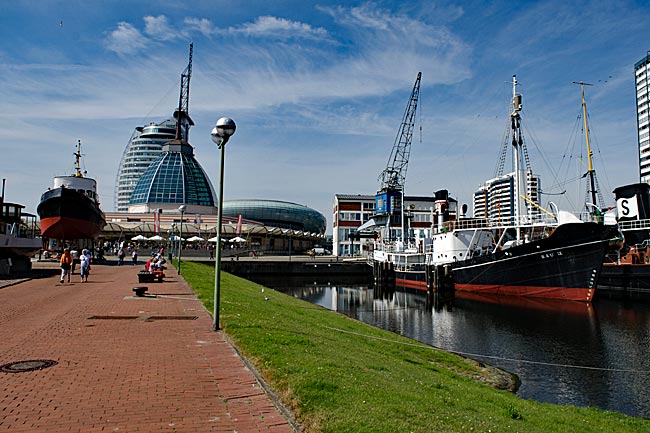
Bremerhaven Havenwelten
Since early 2008, Bremerhaven has not only had a new tallest building but also a new landmark in its Weser-side skyline with the ATLANTIC Hotel SAIL City, which rises 147 meters directly behind the Weserdeich. Architecturally, the structure perfectly embodies a maritime city - it stands like a powerful, rounded ship's superstructure. On the 20th floor, at a height of 77 meters, there is an observation deck (SAIL City) that is also accessible to non-guests.
read more ...
German Emigration Center Bremerhaven (Deutsches Auswandererhaus®)
Opened in 2005, the German Emigration Center® vividly and engagingly presents the history of emigration to America across five eras, spanning from 1830 to 1974. In total, 7.2 million people departed from Bremerhaven to seek a new home and build a new life beyond the Atlantic. For its emotionally compelling and historically grounded exhibition, the museum received the European Museum Award in 2007.
read more ...
Bremerhaven - Überseehafen (Overseas Port)
In addition to the Old Harbor (now the Museum Harbor), which was the first to be built, other ports were later added. Adjacent to the New Harbor lies Kaiserhafen I, the first in a series of additional harbor basins. Even a glance into this initial section of the expansive port area reveals a different world of maritime activity - one of large ships. And we will see even larger ones along the five-kilometer-long quay on the Weser.
read more ...
Bremerhaven - Schaufenster Fischereihafen (Fishery Harbor Showcase)
Away from the Havenwelten and older than both the Emigration Center and Klimahaus is the "Fishery Harbor Showcase." In fact, the Fishery Harbor was originally Geestemünde's deep-sea fishing harbor, built between 1891 and 1896. After a period of decline and decay - including partial demolitions - the idea emerged to transform the area into a maritime experience world. In 1990, efforts began to restore Fish Packing Hall IV, the oldest surviving hall, which had been slated for demolition just shortly before.
read more ...
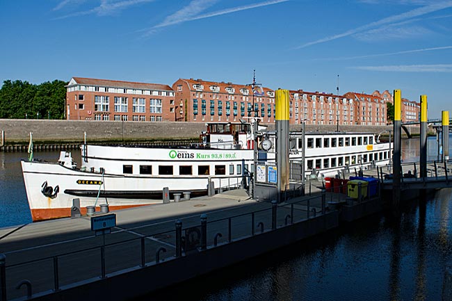
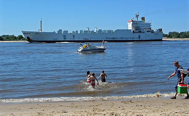
Cuxhaven - a day trip
Many people from Bremen consider the seaside resorts of Cuxhaven to be "their home beach." The coastal city at the mouth of the Elbe is easily accessible from Bremen by car via the A27, which passes by Bremen and Bremerhaven before ending in Cuxhaven. By train, the journey takes a bit longer with a transfer in Bremerhaven. However, even in the off-season, Cuxhaven with its seaside resorts is a great destination for an outing - for example, by bicycle.
read more ...
Brake & the River Island of Harriersand
As soon as spring arrives and the temperatures reach around 20 degrees, many Northern Germans are drawn to the North Sea coast. The main attraction? A beach to lie in the sun and sand for children to dig and build castles. This also draws many people from Bremen to the highways heading north on warm weekends, equipped with bags packed and picnic baskets ready for a day of seaside relaxation. But why travel far when the nearest beach is just around the corner? A visit to Brake and Harriersand proves that.
read more ...
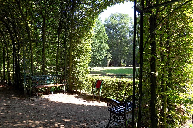
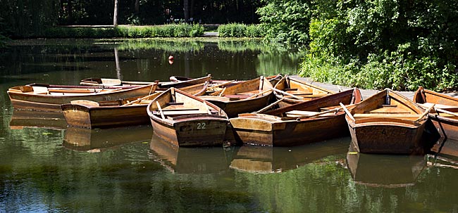
Water-based activities in Bremen
Given that Bremen is a city on a major river with numerous lakes, it makes sense to extend sports or other personal water-related activities from land to water. The most family-friendly activity on the wet element is certainly taking a rowboat ride along the canals of Bürgerpark.
read more ...
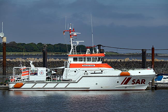
DGzRS - The Maritime Rescuers
Anyone in distress at sea today has far better chances of receiving help, even out on the open water, thanks to modern technology and professionals who take care of it. Along Germany’s North and Baltic Sea coasts, these are primarily the approximately 1,000 full-time and volunteer men and women of the DGzRS (German Maritime Search and Rescue Service), also known as "The Maritime Rescuers." In 2020 alone, they conducted 1,720 operations and rescued 357 people. Since its founding, the organization has helped 86,000 individuals.
read more ...
The East Frisian Island Wangerooge
Among the inhabited East Frisian Islands, Wangerooge is the second smallest (7.94 km²) after Baltrum and car-free, making a stroll through town much more pleasant compared to other islands, especially since distances can easily be covered on foot. From the small train station, you're just a few steps away from the heart of the village, quickly finding yourself in front of the unmistakable Old Lighthouse, which now houses the island museum. From 1856 to 1969, this lighthouse served as a maritime navigation aid, guiding ships safely along their routes. Just how far its light could be seen becomes clear when you climb the 149 steps to the lantern room—from there, you can step out onto the surrounding gallery and enjoy a sweeping view of the island and the North Sea.
read more ...
Wilhelmshaven – Seaside City on the Jadebusen
It's hard to imagine Wilhelmshaven without its naval presence, as the city only developed after a naval base was built in the 19th century. Even today, the German Armed Forces (Bundeswehr) maintain a large base here with several squadrons. Yet, there is much more to discover in this port city beyond its military significance.
read more ...